Remote sensing based crop irrigation mapping for Aga Khan Rural Support Programme (India) to understand Agriculture-Irrigation status in Tribal & Non-Tribal districts.
EIA
GIS based complete EIA Solutions for many organizations included with brief report and Landuse related maps (Toposheet, Elevation, Slope, Aspect, Hydrology, Geology, Landuse, Soil, geomorphology, Village maps) from NABET approved Experts.
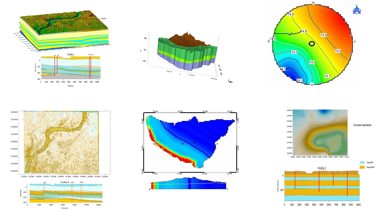
Groundwater
MODFLOW based complete groundwater Solutions for many organizations included with brief report and modelling (Regional Flow, Aquifer description, GW trend, Hydrograph & various Modelling) from NABET approved Experts.
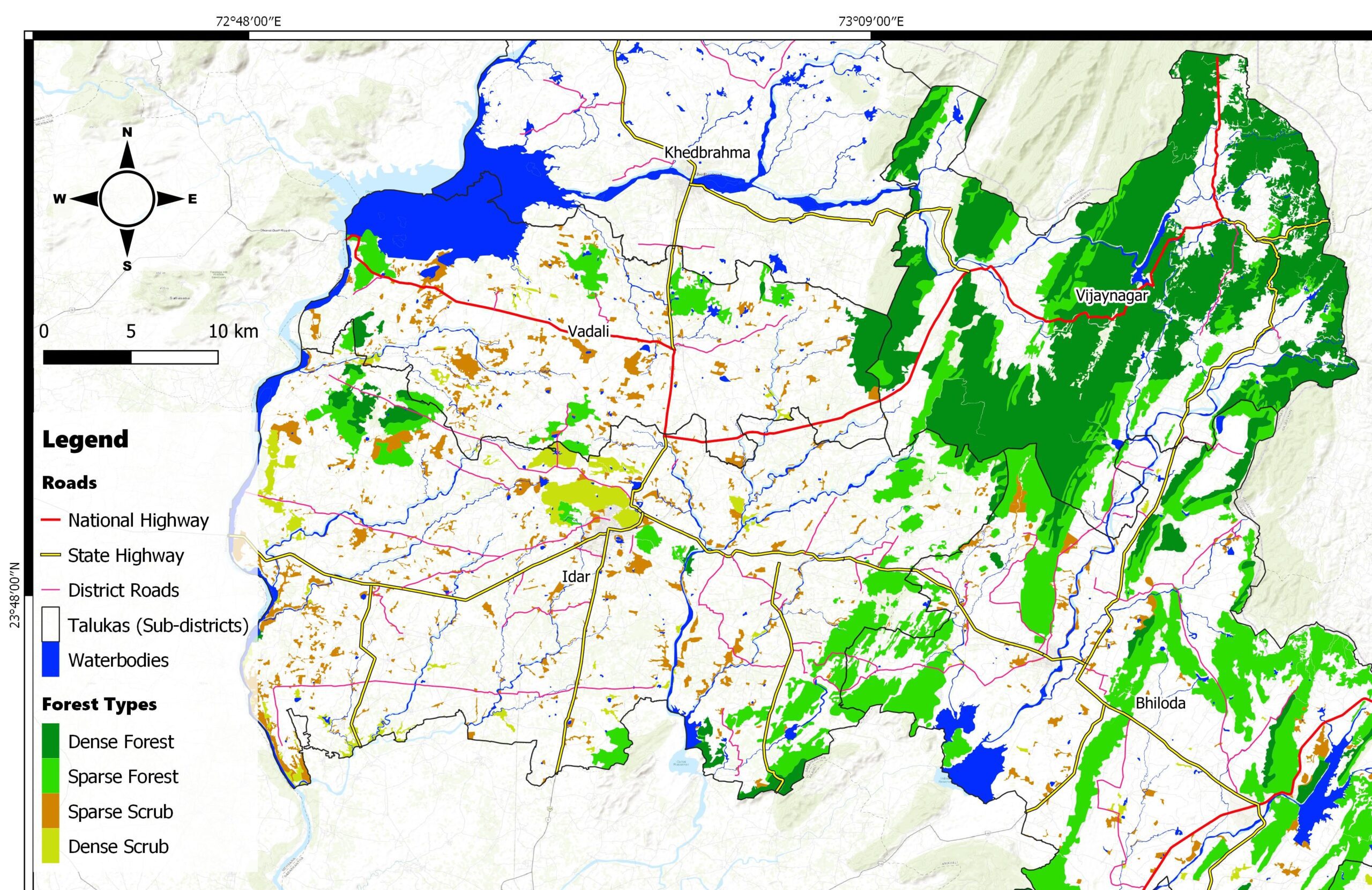
Forestry
Forest cover mapping and Ecological Sustainability Index for Ecological Commission of Gujarat
Hydrology
Multi-temporal analysis for historical flood or waterlogging observation/Water Signature Detection projects with remote sensing based algorithm & techniques.
Hydrology
Flood modelling/mitigation project for estimating Flood Water Depth for Upcoming Ecotourism site of Gujarat state.
Landuse Mapping
Landuse/Landcover Mapping for Oxford University using AI(Artificial Intelligence) & ML (Machine Learning) tools with an accuracy assessment using high resolution satellite images.
Mineral Exploration (Geology)
GIS based complete EIA Solutions for many organizations included with brief report and Landuse related maps (Toposheet, Elevation, Slope, Aspect, Hydrology, Geology, Landuse, Soil, geomorphology, Village maps) from NABET approved Experts.
Sociology & Demography
Post election analysis has been done for UP election 2017 using Bivariate & Multivariate GIS methods combining electoral and demographics data.
Would you like to start a project with us?
Contact us for any customised consulting project or workshop to that you would like us to conduct for your organisation